

June 18, 2020
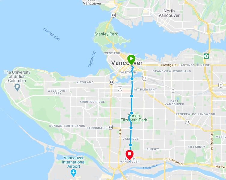
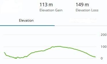
I learned from a Japanese friend the art of urban hiking. You discover neighborhoods and see how the place you live changes as time passes by.

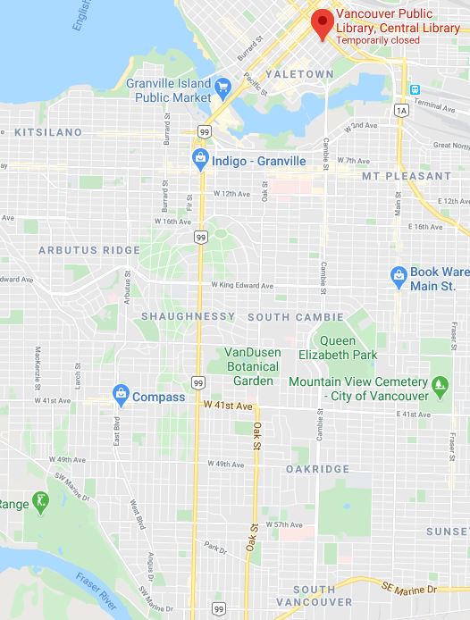
A pleasant place to start this journey is in the Vancouver Public Library. The public space opened in May 1995 is noted for its resemblance to the Colosseum, wrapped in a colonnaded façade that spirals out to create interior and exterior civic spaces.

The opening of the Main Post Office (1953-58) marked the beginning of Vancouver’s development as a regional centre in the postwar era. At the time, it was one of the largest Federal Government buildings in western Canada.

Currently, the post office building is slowly being converted to be Amazon's largest Vancouver office retail, grocery store, and high-end food hall.

As you head down to Cambie Bridge, on your left side, near the B.C. Place you will see the Terry Fox Memorial. This four-piece sculpture grows in stature as they move forward, as Terry’s legacy has done since 1981.

The figures are running towards Stanley Park, where Terry intended to end the Marathon of Hope in December 1980.

I recommend you do this walk in the south-east side of Cambie. As you start crossing the bridge, you will see buildings such as the Ark. This new luxury high-rise building features a unique architecture with its facade designed to emulate a waving flag.

In this city, with its astronomical land values and ever-increasing construction costs, developers build what they know can sell. The unfortunate aggregate effect is a repetitious and lackluster city-wide color scheme.

Wildlife is returning after several decades following the suspension of industrial activity in the area. In an unusual sighting, in May 2010 a grey whale entered False Creek and traversed its length before returning to the open waters of the Strait of Georgia.

The False Creek Neighbourhood Energy Utility uses waste thermal energy captured from sewage to provide space heating and hot water to buildings. This recycled energy eliminates over 60% of the greenhouse gas pollution associated with heating buildings.

The 9-foot tall headless cast iron figures walk aimlessly without guidance or reason. It addresses the transformation and loss of the individual within a group.

Built during the depths of the Depression, the City Hall was a symbol of the newly enlarged city, the result of amalgamation with Point Grey and South Vancouver.

The section from West 6th avenue to West King Edward Avenue is known as Cambie Village. The existing low-rise rental buildings between 19th and 24th Avenue are not affected by redevelopment.

A different tale happens after crossing King Edward Avenue. Developers are snapping up single-family homes to redevelop the land into high-density housing.

King Edward Avenue is the start of the Cambie Heritage Boulevard.

The boulevard is the product of the 1930 ‘Plan for the City of Vancouver’ a grand urban master plan produced to beautify the city and improve its functionality, and the Plan’s revision in 1947.

Queen Elizabeth Park, known for its mountain views and gardens, has changed little in decades, even as the surrounding Cambie Corridor area is experiencing an explosion of townhouse and condo construction.

But this won’t last forever as the Vancouver park board is developing a master plan for Queen Elizabeth Park to accommodate the needs of a growing population.

The next part of this outing takes you to Oakridge Municipal Town Centre.

This area will have the most significant concentration of urban uses and density in the Corridor. It will have mid-rise and tower buildings with retail uses at street level.

I find Vancouver a place that is so desirable to the wealthy that we have social segregation and home prices decoupling from local incomes.

To the south of 49th Avenue, you will enjoy the serenity of the Langara Golf Course, open year ‘round.

Be wary of flying golf balls if you walk on the treed green trail next to the golf course.

Your journey will end as it started, by looking at the most expensive building modality, high-rise residential towers, the product of an interesting cycle that starts with the City only allowing a small percentage of the land for construction.

Building high-rise residential towers give developers and landowners massive rewards, with the City capturing a portion of those rewards in the form of property taxes and development fees.

If you have 45 minutes to spare, you can walk to the North Arm Bridge. It spans the north arm of the Fraser River, linking Vancouver to Richmond.

Logging is a major industry in BC. Trucks move logs from logging areas to a sorting yard, often located beside a body of water where they are tied together to make rafts and pulled them downriver.

BC is doing less processing of raw logs and instead selling the raw material for shipping overseas.


